Mírová pod Kozákovem

The sprawling village of Mírová pod Kozákovem is located between the town of Turnov and Mount Kozákov at an elevation ranging from 240 to 744 meters above sea level. It consists of 14 hamlets: Bělá, Bukovina, Dubecko, Hrachovice, Chloumek, Chutnovka, Kvítkovice, Loktuše, Prackov, Rohliny, Sekerkovy Loučky, Smrčí, Stebno, and Vesec. A significant portion of the western slope of Kozákov, on whose slopes semi-precious stones (agates, jasper, chalcedony, quartz, smoky quartz, amethyst, etc.) have been found since time immemorial, belongs to one of the municipality’s four cadastral districts. The earliest records of some parts date back as far as 1230.
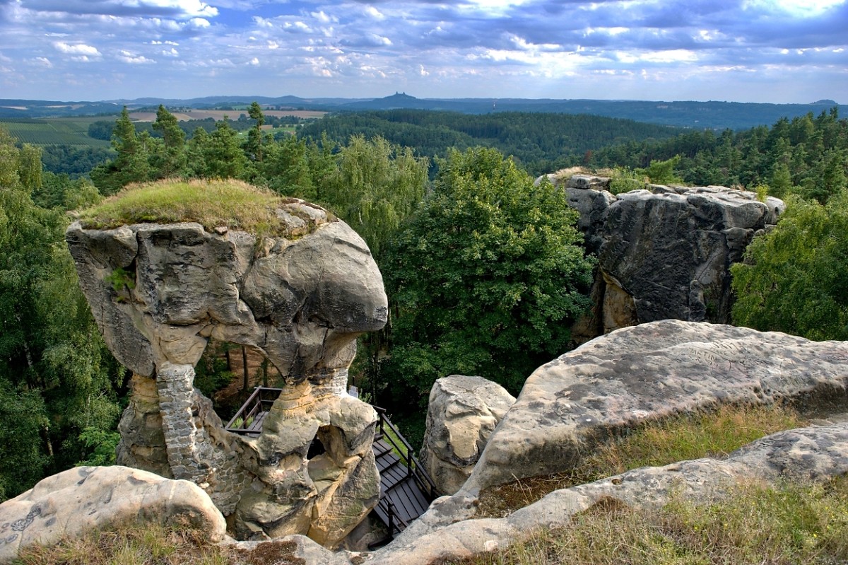
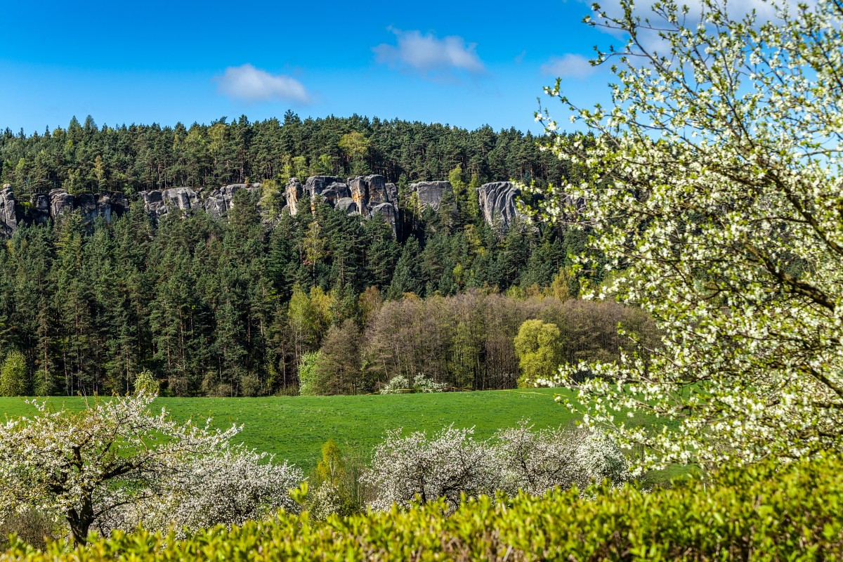
The local landscape has a completely unique character influenced by geological processes during the Tertiary period. At that time, the so-called Lusatian Fault caused the Kozákov Range to rise relative to the plateau where the edge of the Cretaceous Sea had left sandstone deposits. These formed the Klokočské Skály Nature Reserve, a popular tourist destination featuring the rock formations of Klokočské and Betlémské Skály and the ruins of the Rotštejn Rock Castle. The distinctive character of the local landscape is further enhanced by numerous small structures of folk architecture, along with protected natural formations.
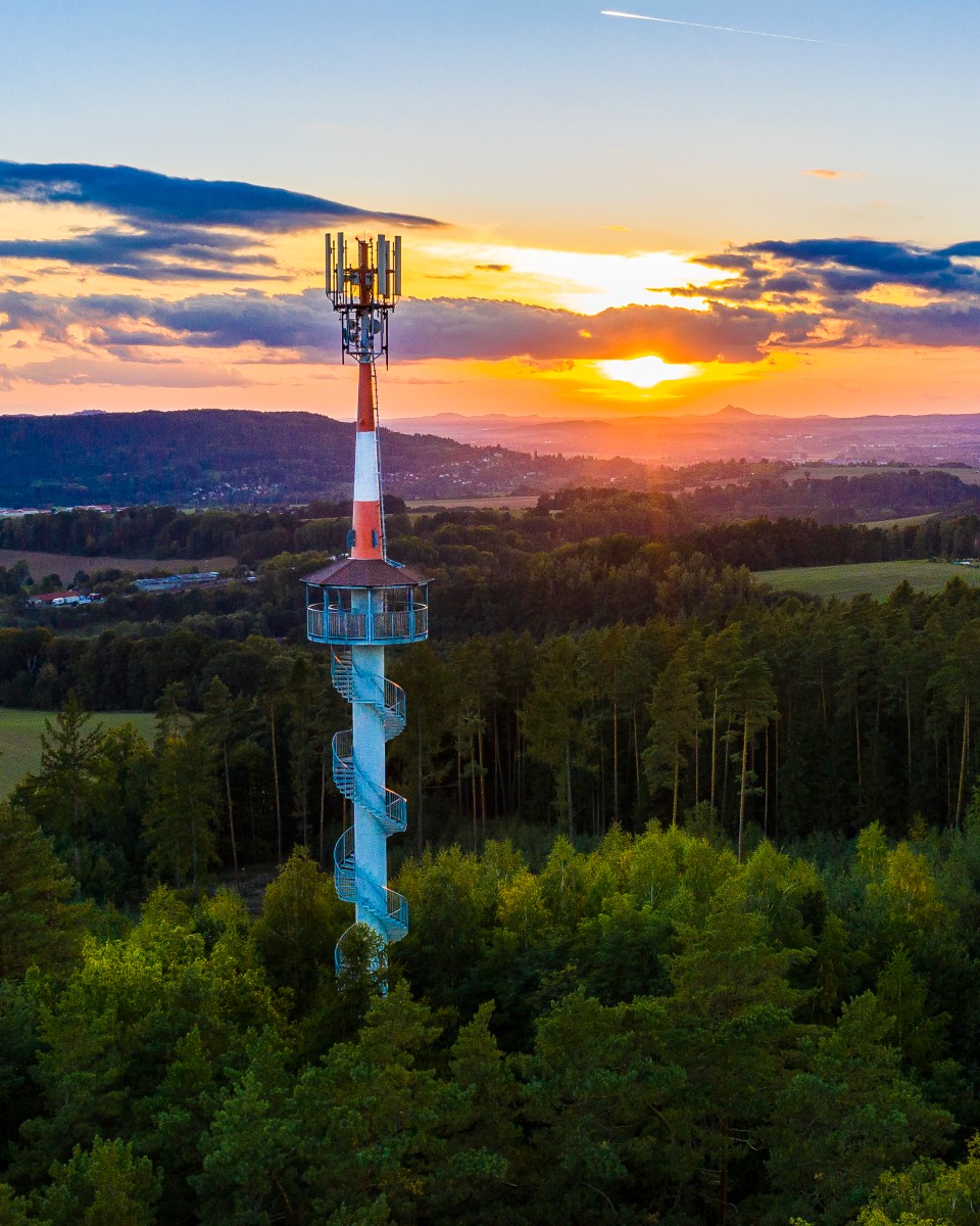
A telecommunications repeater was built on an elevated site in the middle of the forest in the Dubecko district; at the request of local residents, it was converted into an observation tower.
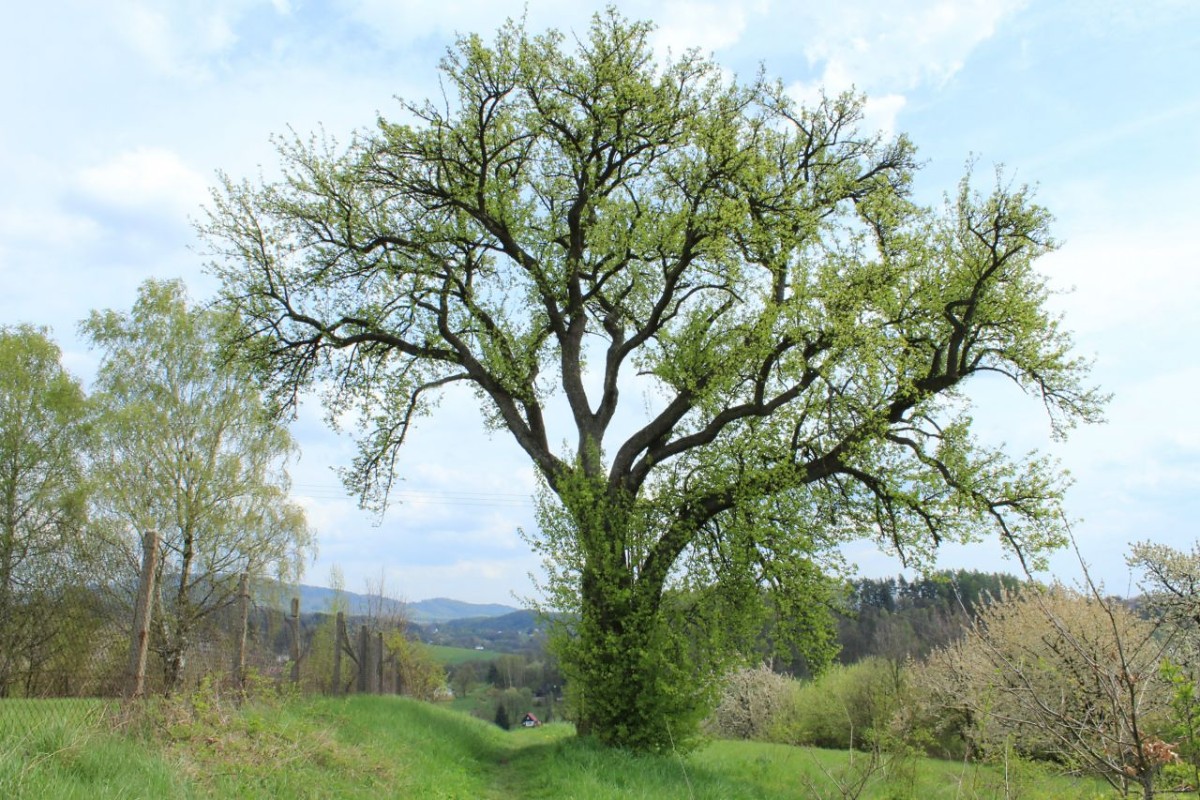
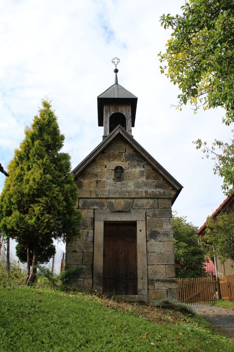
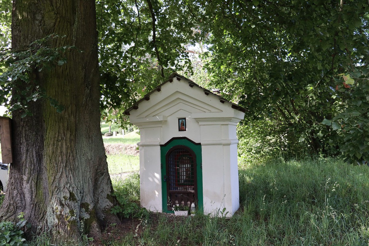
On the border between the hamlet of Bělá and Turnov stands a historic pear tree, a graft of which was planted at Vyšehrad in 2000 as the Tree of the Millennium. Other points of interest in the village include the chapels in Prackov and Dubecko, as well as the Postojná Cave in the Klokočské Rocks.
The village of Mírová pod Kozákovem is located in the Bohemian Paradise, which offers ideal conditions for year-round recreation, sports, hiking, and cycling. Due to its size, the village does not have a single central hub; each part of the village maintains its own cultural life through its local associations and with the support of the municipal office, which is currently located in a former school in Chutnovka.
Smrčí
Welcome to the hamlet of Smrčí, one of the fourteen districts of the municipality of Mírová pod Kozákovem. Smrčí is located in the cadastral area of Vesec pod Kozákovem, as is the nearby hamlet of Prackov. The first written mention of the hamlet dates back to 1383.
Cultural life in Smrčí centers around the village green and the adjacent fire station with a hall, where firefighters regularly meet with their association. The village features a war memorial and a small brick chapel.
The Stebenka Stream flows through Smrč and other settlements of the village of Mírová pod Kozákovem, eventually emptying into the Jizera River.
Mírová pod Kozákovem is part of the Bohemian Paradise Protected Landscape Area, which offers ideal conditions for year-round recreation, sports, hiking, and cycling. In the immediate vicinity of the village, you can visit the Klokočské and Betlémské Rocks, the hamlet of Dubecko with its chapel and lookout tower, the ruins of Rotštejn Castle, or Kozákov, the watchtower of the region.
The film *The Fair Has Come to Us* (the scene with the greenhouse) was filmed between Smrčí and the village of Koberovy in 1973.
Záholice
The sprawling village of Mírová pod Kozákovem is located between the town of Turnov and Mount Kozákov at an elevation ranging from 240 to 744 meters above sea level. It consists of 14 hamlets: Bělá, Bukovina, Dubecko, Hrachovice, Chloumek, Chutnovka, Kvítkovice, Loktuše, Prackov, Rohliny, Sekerkovy Loučky, Smrčí, Stebno, and Vesec. In the village and its immediate surroundings, you can visit, for example, the Klokočské and Betlémské Rocks, the hamlet of Dubecko with its chapel and lookout tower, the ruins of Rotštejn Castle, or Kozákov, the watchtower of the local region. The earliest records of some parts of the village date back as far as 1230.
The rocks of Klokočké and Betlémské skály
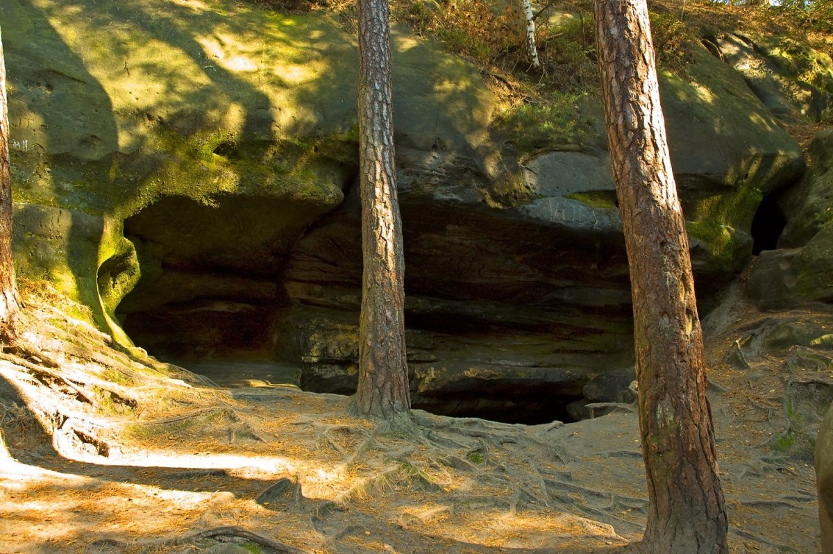
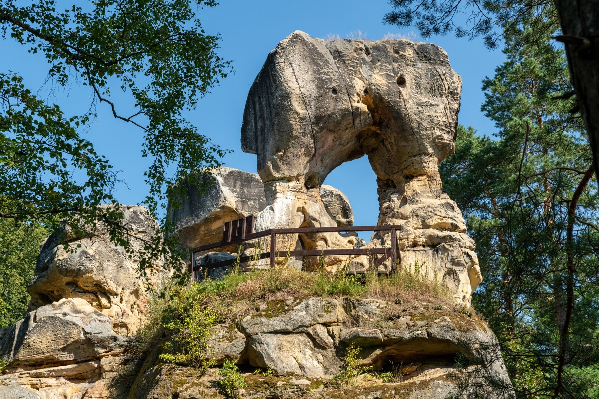
The Klokočské skály Nature Reserve is a rock formation composed of Paleozoic sandstones up to 60 meters thick, featuring numerous cave cavities. The largest underground space in the area is the Postojna Cave in Zelený důl, also known as Amerika, the largest pseudokarst cave in the Bohemian Paradise. In the southeastern part of the Klokočské skály lies the ruins of Rotštejn Castle.
The Betlémské Rocks are part of the Klokočské Rocks Nature Reserve. They form its northern spur, which slopes down toward the Jizera River. Their name is derived from the Betlémský Mill, which once stood at the mouth of the stream flowing from Podloučky into the Jizera River. A red-marked trail from Turnov to Kozákov runs through the rocks. At their edge, you’ll find the Zdenčina skála lookout point, built on a 10-meter-high rock outcrop with carved steps, offering a beautiful view of the Jizera River valley.
Bělá
The village of Bělá is one of the fourteen districts of the municipality of Mírová pod Kozákovem. It is located in the cadastral area of Bělá u Turnova, which also includes Bukovina, Chloumek, Rohliny, and Záholice. The first written mention of the village dates back to 1322.
A nearby point of interest is the watermill known as Podchlomecký, located in the hamlet of Podchloumek between Bělá and Turnov. The first written mention of the mill dates back to 1613, but it was likely in operation much earlier. The miller’s coat of arms is artistically depicted on the building’s facade. With the arrival of a new miller’s family in 1707, the Chapel of St. George was built near the mill. Currently, the mill serves only as a residence; its operations ceased in the mid-20th century.
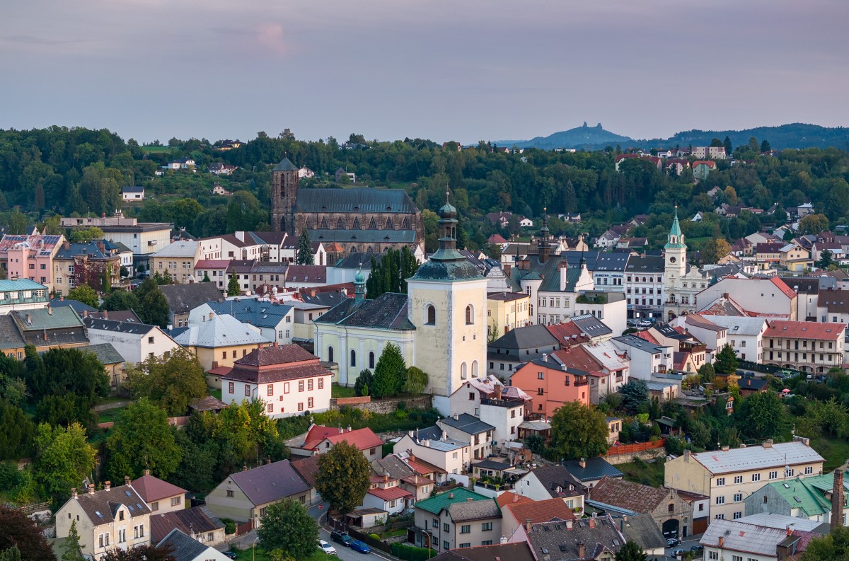
Turnov - the Heart of the Bohemian Paradise
The town of Turnov lies along the middle reaches of the Jizera River in the picturesque Bohemian Paradise region. It was founded in the mid-13th century by Jaroslav and Havel of the Markvartice family. Turnov became famous for gemstone processing and jewelry making, and especially for the production of jewelry featuring Czech garnets. You can learn more about this tradition at the Bohemian Paradise Museum or the Granát Customer Center. Among Turnov’s most significant landmarks are Hrubý Rohozec Castle, the Turnov Synagogue, Valdštejn Castle, and the Dlask Farmstead in Dolánky near Turnov.
Thanks to its location, Turnov is an ideal starting point for exploring the Bohemian Paradise. As early as 1955, the first protected landscape area in the country—the Bohemian Paradise Protected Landscape Area—was established here. The main reason for its establishment was the extraordinary ruggedness of the landscape, featuring characteristic rock formations and unique plant and animal communities. In 2005, the Bohemian Paradise was included in the European Geoparks Network, and ten years later, the Bohemian Paradise Geopark became a member of the UNESCO Global Geoparks Network.
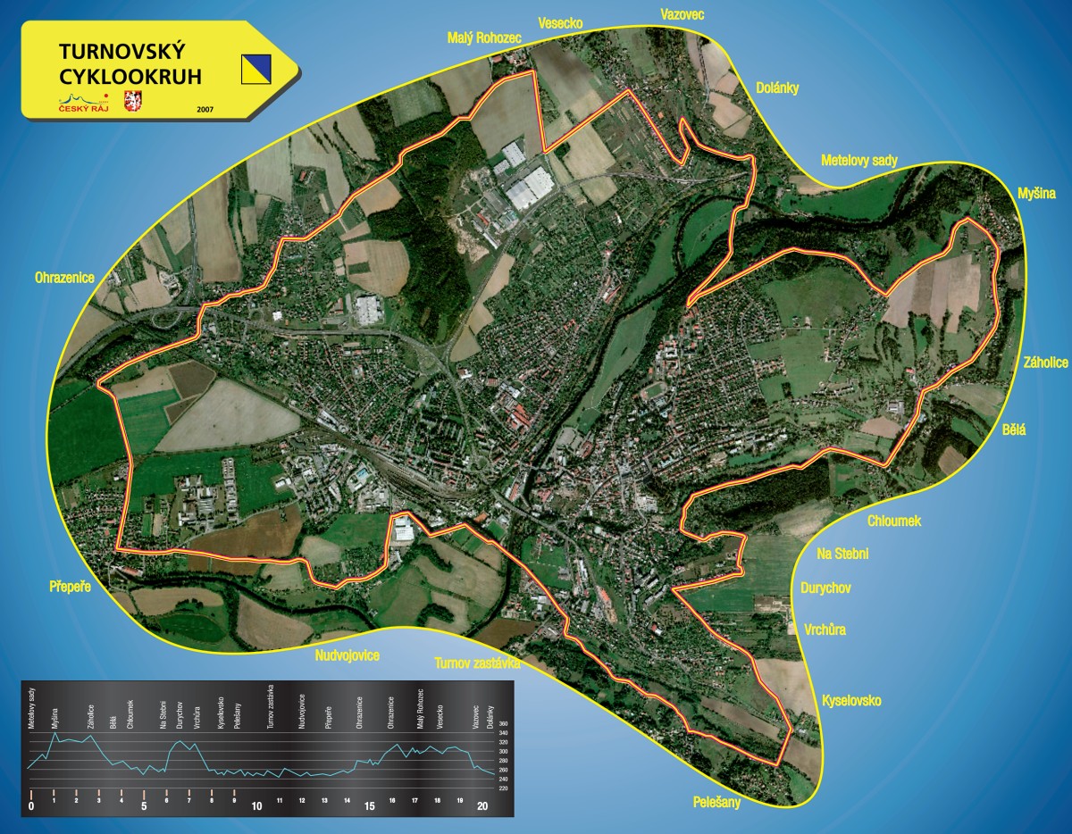
The Turnov Cycling Loop
You are on the Turnov Cycling Loop, which is marked with local signage and follows existing bike paths. The loop is 24 km long and connects key locations, landmarks, and starting points for your cycling trips.